
Navigation
Ever Wanted to Zoom In on Your Old House From Space? This Satellite Map App Lets You
A satellite map app that combines live Earth imagery, 3D street view of famous landmarks, nearby-place search, and everyday GPS tools, useful for planning a trip or just satisfying idle curiosity about your own street from orbit.
About this app
There is a very specific kind of late-night curiosity where you open a map app not because you need directions anywhere, but because you want to see what the Eiffel Tower looks like from a satellite, or check whether your childhood house still has that tree out front. That itch is basically the entire reason this app exists.
A Satellite Map App With More Than One Job
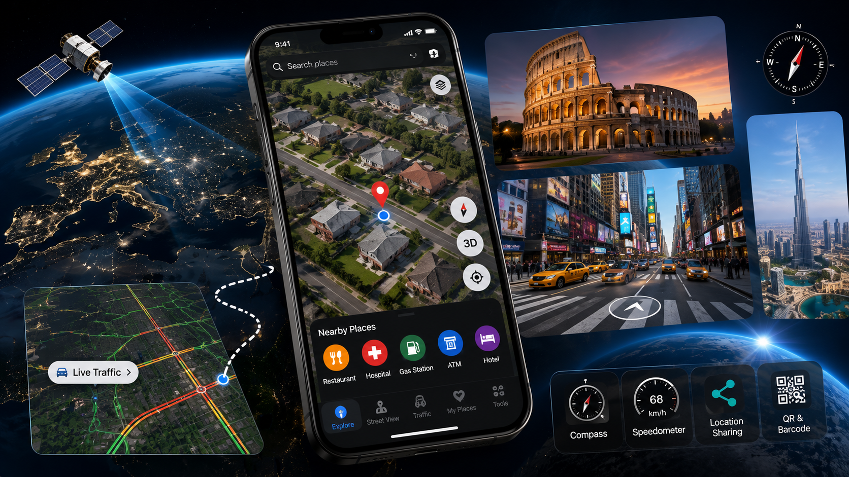
Live Earth Map 3D: Satellite covers two different needs at once. Half of it is a genuine exploration tool, satellite imagery you can zoom into plus 3D street view of famous landmarks and tourist spots around the world. The other half is a practical navigation companion: nearby places, live traffic, and a set of GPS tools that would normally live in three separate apps.
What Is Actually Inside
- Detailed satellite and live Earth maps: zoom into cities, coastlines, and landmarks from a live satellite view instead of a flat, static map tile.
- 3D street view of famous places: walk through iconic landmarks and tourist destinations virtually, no flight required.
- Nearby place search: hospitals, ATMs, gas stations, restaurants, and hotels surfaced directly on the map around the current location.
- Live traffic overlay: check road conditions before leaving so you are not the one person who did not know about the closure.
- Journey tracking: log distance, route, and duration while traveling, useful for anyone who likes a record of their trips.
- Everyday GPS extras: a built-in compass, speedometer, location sharing, and a QR and barcode scanner tucked into the same app.
A couple of caveats worth knowing
This is a newer listing, sitting at just over a thousand downloads so far with no public rating yet, which means anyone trying it now is ahead of most reviewers rather than behind them. The app itself is upfront that satellite imagery, traffic data, and nearby-place results depend on region and network connection, so accuracy will vary more in less-mapped areas than in a major city. It carries ads and in-app purchases, and holds a 3+ content rating.
For a single satellite map app that covers both idle world-exploring and actual trip navigation, it manages both without much fuss, just go in knowing it is still building its track record.